Colonel Ronan
Continue...?
- Joined
- Jul 14, 2007
- Messages
- 19,410
- Likes
- 169
- Points
- 63
http://www.bbc.co.uk/news/science-environment-15735625
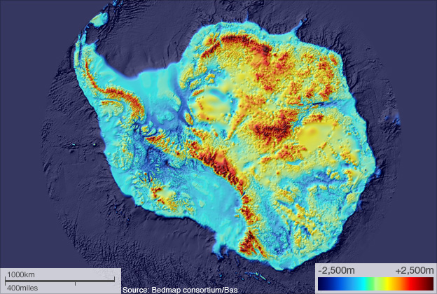
Scientists have produced the most detailed map yet of the White Continent's underbelly - its rock bed.
Called simply BEDMAP, this startling view of the landscape beneath the ice incorporates decades of survey data acquired by planes, satellites, ships and even people on dog-drawn sleds.
It is remarkable to think that less than 1% of this rock base projects above the continent's frozen veil.
In the map at the top of this page, the highest elevations are marked in red/black. The light blue colour shows the extent of the continental shelf.
The lowest elevations are dark blue. You will note the deep troughs within the interior of the continent that are far below today's sea level.